Climate Resiliency Tools
Communities across the country and around the world are faced with the challenge of managing risks and enhancing resiliency in the face of increasing climate hazards.
The good news is that most communities don’t have to start from ground zero to take effective steps in resiliency planning. Models and other already available data within a city/town, or in the broader scientific/public domain, can be used as the foundation to build upon. Hazen has pioneered several innovative tools and approaches to build from those existing tools and take the next steps: identifying and assessing risks and vulnerabilities; evaluating cost-effective resiliency strategies; and implementing a plan for adaptation.
Related Topics:
Resiliency Frameworks and Tools
Hazen has developed and implemented effective resiliency frameworks and innovative tools to support robust climate change planning and risk mitigation.
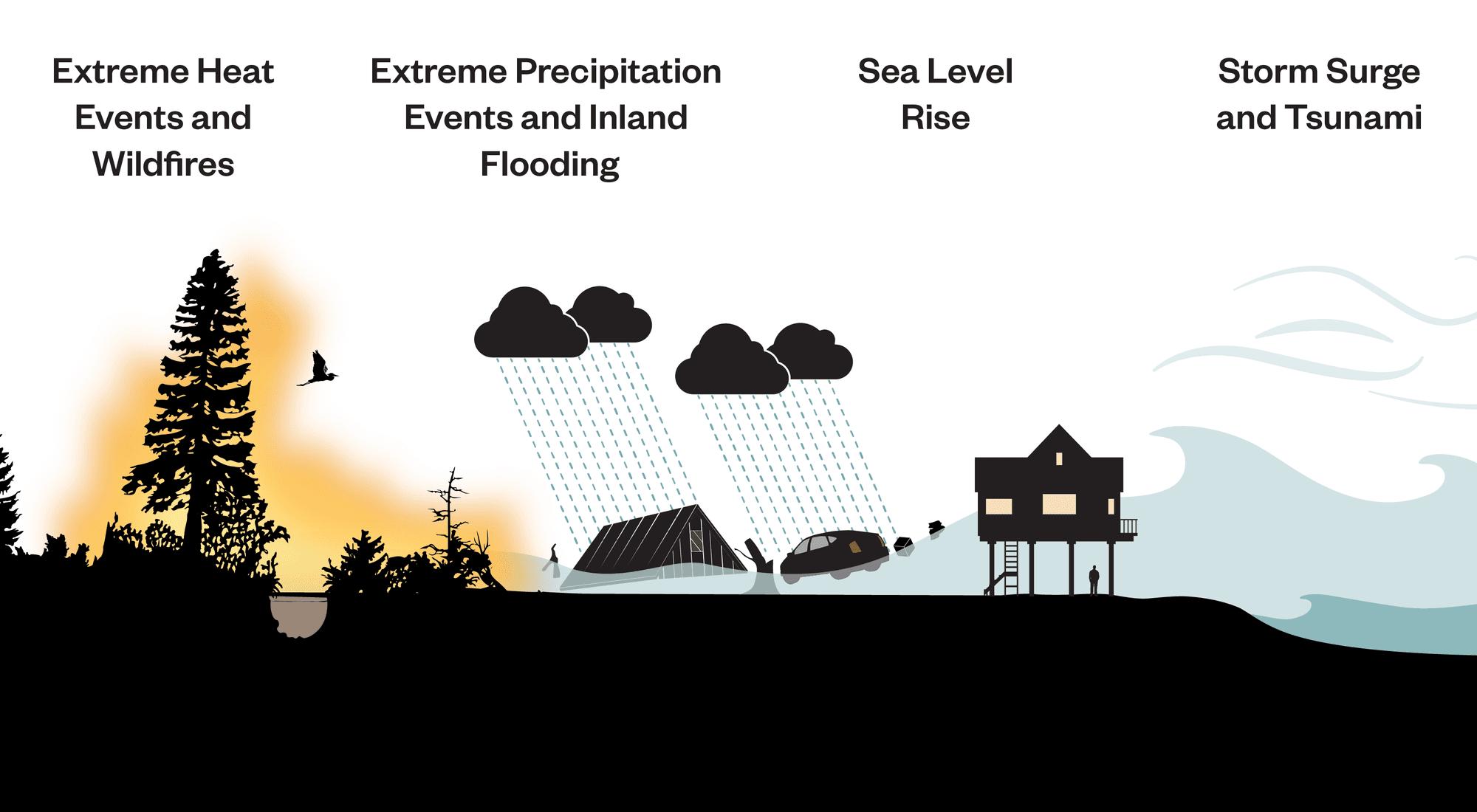
Climate change presents critical challenges to the management and operations of water and wastewater infrastructure. Rising sea levels, increasing storm intensities, longer drought periods, and more frequent heat waves all affect a community’s ability to manage and protect source waters, supply clean drinking water, collect and treat wastewater, and mitigate flood hazards. In many cases communities are faced with planning for not just one, but multiple overlapping future climate change threats.
Climate risks differ throughout the country, requiring that resiliency strategies be tailored based on each utility’s specific circumstances. The following case studies include projects from a diverse mix of geographies, using a range of resiliency strategies.
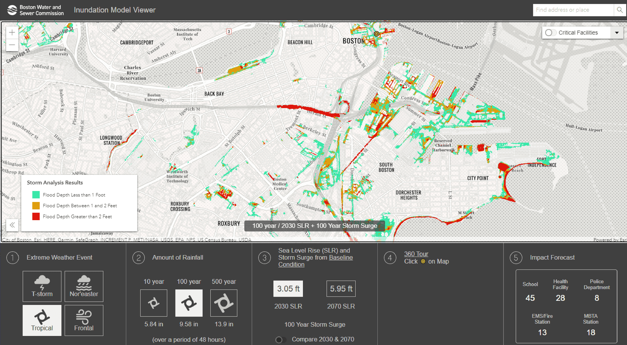
CASE STUDY: For the Boston Water and Sewer Commission, Hazen used existing 1D hydraulic models as a starting point to develop a 2D model that predicts flooding from varied coastal and rain events throughout the city. GIS tools assessed impacts and vulnerabilities to critical infrastructure resulting from different inundation scenarios. Hazen analyzed dynamic rainfall events (thunderstorm, frontal, tropical, nor’easter) for 2-year and up to 500-year frequencies, and developed a web-based ESRI story map with a custom flooding results viewer. Several 360-degree photographic renderings were created of landmark locations throughout the city to clearly illustrate potential flooding within streets, against buildings, and more. This unique delivery of what has historically been very complex modeling data allows for a very distilled communication of flooding impacts to a wide variety of audiences, both technical and non-technical.
The Boston Inundation Model Viewer allows users to choose from a variety of storm and sea-level rise scenarios.

CASE STUDY: Like many other coastal communities in South Florida, the City of Fort Lauderdale is grappling with the challenges associated with creating a resilient future in the face of climate change, and particularly rising sea levels. With much of the city having ground elevations just a few feet above current mean sea level and more than 160 miles of waterways traversing the city, the task at hand is critical and complex.
In 2016, the city selected Hazen to assist with its Stormwater Masterplan Modeling and Design Implementation efforts, a major component of which is resiliency in the face of climate change. One of the primary tools used in this long-range, carefully phased battle is a comprehensive hydrologic and hydraulic (H&H) model. Historical modeling efforts in the city and throughout the region were not sufficient, as they did not simulate the interaction between surface and groundwater in robust enough fashion.
Hazen built upon the city’s existing information by selecting a modeling platform, collecting data, and building a model that appropriately connects surface and groundwater. This tool has already been used to begin designing stormwater/resiliency infrastructure investments in seven initial areas of the city, and will be a dynamic tool in further assessing, planning, and designing improvements and enacting policies to help ensure the resiliency and prosperity of Fort Lauderdale for decades to come.
CASE STUDY: Orange County (CA) Sanitation District was one of the first wastewater agencies to conduct a comprehensive climate change resiliency study with the objective of identifying and mitigating risks to the operation of two treatment facilities, 15 pump stations, and a significant capital improvement program.
Using the City’s existing record drawings and other accessible information as a starting point, Hazen assessed flooding and sea level rise using FEMA 100-year and 500-year flood levels. California’s 4th Climate Change Assessment was used to develop projections for sea level rise for 2050 and 2070. Wildfire and extreme heat risks were also evaluated using data from California’s 4th Climate Change Assessment and the state’s Cal-Adapt website.
Four categories of adaptation strategies were evaluated for OCSD facilities: boundary, building, asset, and operation. Selected strategies included revised emergency response plans and design guidelines specific to the locations and risks to each piece of critical infrastructure. For example, the Sanitation Districts of Los Angeles County and the City of Simi Valley have reclamation facilities in communities surrounded by forest and brush that have more vulnerability to wildfire, in desert communities more likely to experience high heat, and adjacent to rivers subject to flooding from changing precipitation patterns. As a result of this work, Southern California’s essential wastewater facilities can be better prepared and resilient to the effects of climate.
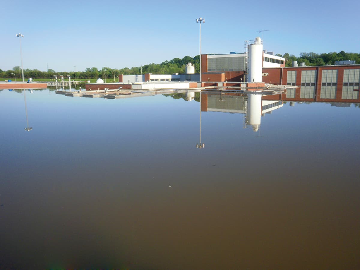
CASE STUDY: The Clarksville (TN) Wastewater Treatment Plant is the only facility that provides wastewater treatment for more than 100,000 residents of Clarksville. When the Cumberland Basin received more than 20 inches of rain in less than 48 hours, it caused massive flooding and the levees and floodwalls surrounding the plant were overtopped and the plant was inundated and heavily damaged.
Clarksville Gas & Water quickly contracted with Hazen to provide disaster recovery services and bring the facility back into operation as quickly as possible. As soon as floodwaters receded, the facility was dewatered to minimize impact to the levees and floodwalls and initial cleanup was completed. Primary treatment returned to operation just 10 days after the flooding. Even with the extensive damage to secondary treatment equipment and the biology of the plant completely lost, secondary treatment was also back in operation in less than three months.
A new perimeter berm was raised above the 500-yr flood elevation and the existing stormwater pump station was improved to handle run-on generated from a 100-yr storm. Throughout the project, Hazen provided daily status updates to the Tennessee Department of Environment and Conservation on damage incurred and the recovery process. Once the event was declared a federal disaster, Hazen worked closely with FEMA representatives to develop proper justification and project worksheets for reimbursement of a portion of the recovery cost.
Our disaster recovery work got the Clarksville facility back online in just 10 days.


